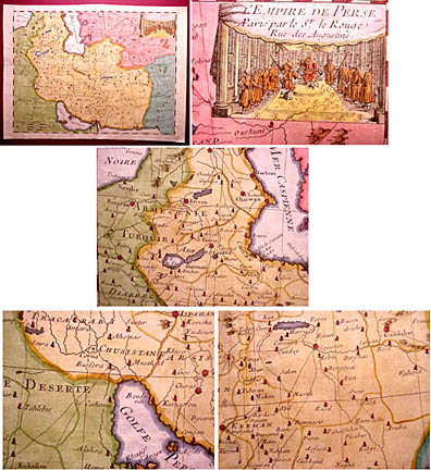
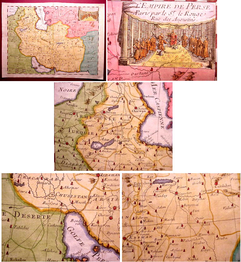
Geography
"L'Empire De Perse" issued 1748, Paris, by
Le Rouge. A nicely detailed and suprisingly uncommon mid-18th
century map of the region referred to as Persia (larger
image). Stretches from Armenia and Turkey across Iraq and
Iran, the Caspian Sea, the Persian Gulf ( Yes the Persian Gulf)
, over to Petit Tartary and what is called "Mogol India".
Includes major rivers, lakes, surrounding islands, political divisions,
as well as major cities and seaports. Many important cities are
signified by tiny cathedral symbols and these are highlighted
in red. With a wonderful large vignette court scene at upper right.
In VG+ to near excellent, clean antiquarian condition. Very pleasing
visually. Sheet measures 12" W x 8 3/4" H, image measures
10 3/4" W x 7 7/8" H.
More Places
Sent by Darius
Kadivar
Email
interesting old photos of ordinary people, places, political leaders,
activists...


